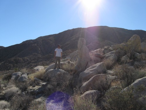
On a small ridge running through Mojave Valley
Well, I took my first backpacking trip. I got my last piece of “necessary” gear – a packable stove – and I had a few days left of vacation, so there were no more excuses. It was a success! Mostly.
Naturally, I chose Rockhouse Canyon in Anza Borrego State Park as my first destination. For those of you who know me, I’m obsessed with the desert, and more specifically, the Anza Borrego desert. I’ve gone there nearly a dozen times over the last six or seven years, and every time I discover something new. This visit was no different. I had been on Rockhouse Canyon Road before but had never taken it the full 9.6 miles to the junction between Rockhouse Canyon and Butler Canyon in the northeast corner of the park.
The challenge before Mike (my roommate) and I: finish the Rockhouse Canyon loop, measuring 24.7 miles, in two days. Lowell and Diane Lindsay describe the trail in Backpacking California, a sizeable compendium of short backpacking hikes all over California put together by serious backpackers. The Lindsays note that the trail should be completed in two to three days. I only had two days to hike, so were left with little choice but to complete the hike in those two days.
Mike and I arrived in Borrego Springs, the small town surrounded on all sides by state park, at 11:30 at night on Thursday, planning to pitch a tent at a primitive site near town. Whenever I arrive in the desert this late, I always choose to camp at Yaqui Well, which lies at the intersection of S-2 and S-3, across the way from the more developed Tamarisk Grove campground. Yaqui Well is a great place to pitch a quick tent at night because the ground is relatively flat. It’s in a wash, so the dirt is soft to the touch. And the vegetation is mostly friendly, with very little cactus in the area. For people who have never been to the desert, Yaqui Well is a rehearsal for the real show. It’s relatively close to the highway, so the desert silence is intermittent, as you’ll probably hear cars drive by in the night. For some reason, I couldn’t sleep much that night. Once I got it in my head that I couldn’t fall asleep, it was all over. I was destined to toss and turn all night.
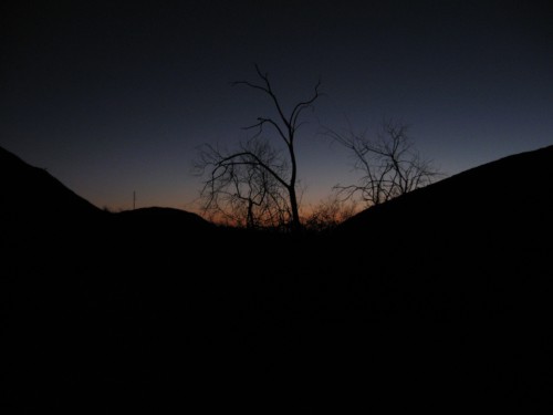
Sun rising at Yaqui Well
Friday morning came, and the first order of business was to grab a hearty breakfast at Kendall’s in The Mall. We ordered Kendall’s Big Breakfasts, and big breakfasts are what we got – two pancakes, two eggs, hash browns, two sausages, two bacon and giant slab of ham. We were done by 7:15, so we headed out to Rockhouse Canyon Road, about 5 miles northeast of town. Traveling at a safe speed, it takes about 45 minutes to get to the junction of Butler and Rockhouse canyons. You can either drive the next 3.1 miles if you have a four-wheel-drive vehicle with high clearance, or you can hike it. I was borrowing my dad’s SUV, so I decided not to risk breaking down in the middle of the desert from slashing a tire and damaging the undercarriage.
We set out for the hike at about 8:30 am at the canyon junction (elevation 1200 feet), eager to knock out a good number of miles before we broke for lunch. I put my pack on for the first time since I backpacked through Europe and my back was aching within 5 minutes! I almost panicked before I adjusted the waist straps so that most of the weight was sitting on my hips. Much better.
The first 3.1 miles are kind of drab, following vehicle tracks to the beginning of the canyon. At 3.6 miles we reached Hidden Springs, which is kind of a misnomer. Yes, it is hidden, because it barely exists. But that means it’s not hidden because it’s not there in the first place. How about “Springs Just Kidding,” or “Bet Your Guidebook Says There Are Springs Here.” Just as another blogger had warned, the only water at Hidden Springs was indeed hidden behind foot-long reeds but contained only about two cups of water. But we didn’t come here for no water! After all, we had packed 5 gallons of water for two days, and it was already taking its toll on our backs, legs and waists.
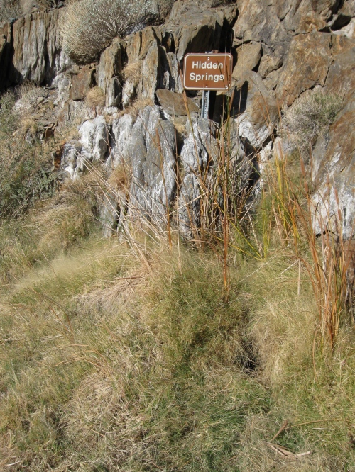
The "Hidden Springs" near the beginning of Rockhouse Canyon
The real treasures of Rockhouse Canyon lay beyond Hidden Springs, where the canyon begins to narrow, and giant boulders of all types of rock are strewn in different formations across the shaded canyon floor. The guidebook instructed us to hop a few boulders about 15 yards before a huge granitic barrier blocks the way up the canyon. It took us about 15 minutes to figure out how we were supposed to get up, but we eventually spotted a few ducks left by previous hikers and scrambled our way up the canyon.
Rockhouse Canyon eventually opens up to the Mojave Valley, which houses several Indian rock house ruins. These rectangular rock houses sit on a small ridge in the middle of the valley and consist of rocks stacked about 3 to 4 feet high. Some people set up camp inside the houses, but we were only halfway, with several miles to go, so we moved on.
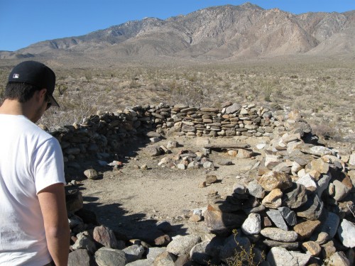
One of three Indian rock houses in Mojave Valley
Following the banks of the wash on the western edge of the valley, we reached Alder Canyon, which held even more impressive rock formations. You never know what the desert holds beyond the bend. Bland desert landscapes can suddenly turn into gorgeous ridges of sprawling ocotillos, otherwordly wind caves, or narrow canyons littered with fallen boulders. Like I said, I always find something new in Anza Borrego, and I’m sure the same will be true for my next trip.
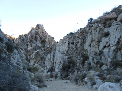
The junction of Alder Canyon and Nicholias Canyon
At 2800 feet in elevation and well into Alder Canyon, we reached a meeting point between Alder and Nicholias canyons. Of course, the book told us this (well, not exactly), and the elevation listed in the book was almost accurate with my GPS, but seeing as how there were three 10 foot dry waterfalls that we needed to pull ourselves over in order to get into Nicholias Canyon, we figured that it couldn’t be the way. An hour and a half later, the sun dipping behind the mountains and our chances at reaching Cottonwood Bench Camp at 4800 feet slipping away, we ended up a few hundred feet farther than the point at which we began to doubt ourselves. We had tried to backtrack to a point where we could scramble up the side of the eastern side of the canyon, walk along the ridge toward the junction, and figure out which way Nicholias Canyon bent. But the only thing the ridge was good for was cactus pricks, slippery rocks, and virtually no way of moving around at a decent pace. By 4:15 we were finally in Nicholias Canyon, beyond the waterfalls, but in no mood or position to go any further. We pitched the tent in the only clearing around, surrounded by cactus. The wind would be rough that night, and the cold was bitter (at least by my standards). Mike built a fire while I cooked up some steak and potato soup and dehydrated Mexican chicken and rice (not half bad).
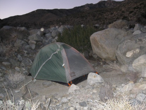
This clearing in Nicholias Canyon just big enough to fit the tent.
So we had reached 4000 feet in elevation where we had set a goal to reach 4800 feet, but I wasn’t too upset. I knew that I would get back here again and understand how to complete the loop. Here, we only had two days, so we knew our only choice was to head back down from the camp in the morning. The wind was relentless that night, but I wouldn’t know because I had a few shots of whiskey and a Tylenol PM that knocked me right out. I needed the sleep, because I had only gotten a couple hours the night before.
After making a tasteless meal of oatmeal mixed with some leftover trail mix, and a good cup of coffee, we set out for Day 2. The soreness was evident from the beginning but nearly as bad as I thought it would be, and of course our pace was much faster going downhill. Ultimately, we were back at the car by 2:30 in the afternoon, and though our feet were killing us for the last three miles, it was generally a relaxing hike (with no fear of getting lost).
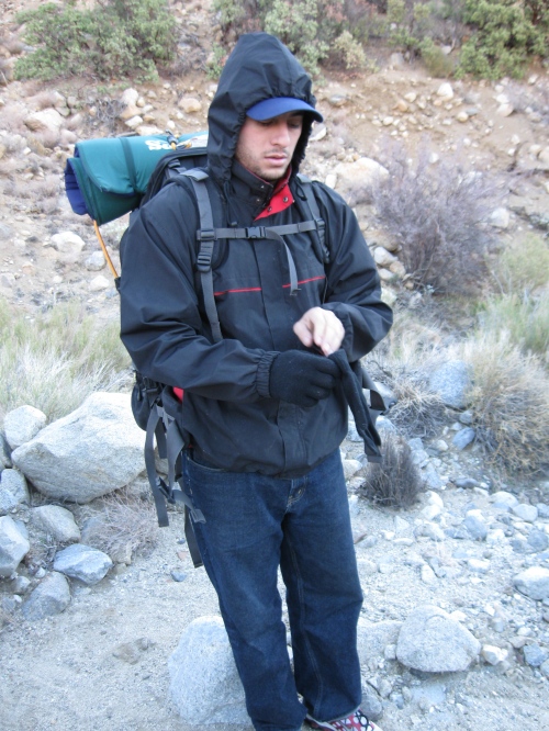
Mike getting ready for Day 2
Back in town, for lunch we headed to the Red Ocotillo at the Palms Hotel and sat poolside with Bud Lights. The other patrons must have thought we were bums. We limped to our table, scruffy beards and all, unashamed that we smelled. A good beer, a great sandwich, and the satisfaction that we had just hiked 25 miles out of shape. Next time, I’ll finish the loop.
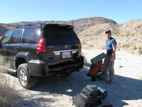
Back at the car, after 25 miles

25 miles in one day is pretty bad-ass.
You guys are hardcore! I think the longest hike I have done in Borrego is closer to 8 miles.
Like the pics,
Bob
We hiked to the Cottonwood bench and back in one very long day hike. We walked down Rockhouse canyon in the dark since it is flat except for the dry water fall section(using head lamps). there is year round water at Cottonwood bench at Toro springs. There is an easier trail to take to the bench. It is an old indian trail that runs East West from the upper rock house ruins to Toro springs. You pass Cottonwood bench on the way to the springs.